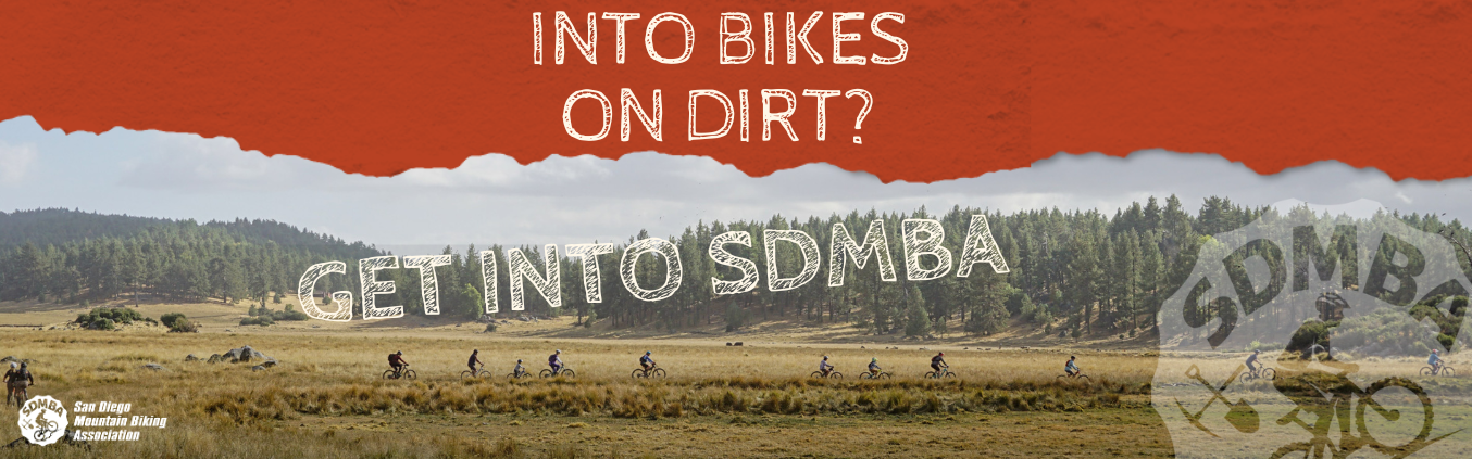
Update: Eastern Otay/Proctor Valley


We are aware of the recent signing and re-fencing of access east of Upper Otay Lake in Proctor Valley in eastern Chula Vista. As most of you know, there are many issues involved in recreational trail access in San Diego. The complexity of land ownership, mitigation and conservation lands, future development mixed in with endangered species, cultural resources and water management is a familiar story. This story continues in the Otay/Proctor Valley area.
Many of you may also be familiar that there have been advocacy and planning efforts ongoing for years as part of the Otay Regional Trails Alignment Study (ORTAS). The goal of ORTAS is to create a cohesive and interconnected trail network in this multi-jurisdictional area that will help improve coordination and lead to better management of the trails, which will also help protect sensitive biological and cultural resources in the area.
There were several meetings held in Chula Vista during 2017-2019 which were well attended by many members of the community including mountain bikers. SDMBA along with other concerned stakeholders have been involved in this effort since it started. Some of the agencies involved continue planning work to move this plan forward. For example, the County of San Diego has just received a $450,000 grant from the State Wildlife Conservation Board to conduct the environmental compliance documents that are needed before this plan can be implemented.
The housing developments planned in Proctor Valley are currently approved but face significant litigation hurdles. There is no clear timeline for when ground might break on any of the proposed housing developments.
The recent step-up in new fencing and potential enforcement in February 2021, from our understanding, seems to be coming from the City of San Diego Public Utilities Department. City of San Diego rangers have been out in recent weeks informing trail users and warning of future enforcement. The public is more than welcome to call the City of San Diego Public Utilities Department to express their thoughts.
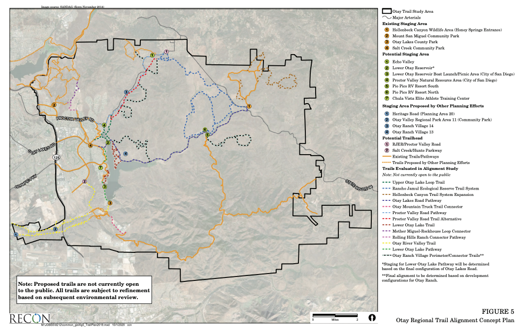
We are particularly asking questions around the red dashed alignment shown on the map below (figure 5 from ORTAS, pg. 24) as “Proctor Valley Road Alternative.” This map states this trail was evaluated in the study but is not currently open to the public. It is our position that this alignment appears to exist and we will ask the question as to why this alignment couldn’t be opened to the public now.
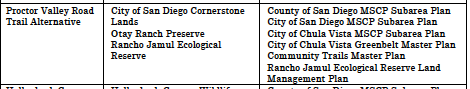
ORTAS; Chapter 3 - Table 2, pg. 19
SDMBA continues to monitor progress on this plan and hold regular meetings with most of the agencies and municipalities involved. We will provide any updates as we gather more information.
-----------
For your reference, here is The Otay Regional Trail Alignment Study (ORTAS) finalized in 2020. It is the definitive document for the future management of this area. Here you will find future trail descriptions and maps as well as information regarding conservation efforts: https://www.sandiegocounty.gov/content/dam/sdparks/en/pdf/Resource-Management/EOTAS_Final.pdf
Quick Summary of ORTAS: This study is the result of a multi-agency effort to identify a coordinated and sustainable trail system in southern San Diego County. The plan designates approximately 80.5 linear miles of trails and pathways within a 72,523-acre study area. Within this area, nine separate ecological preserves and habitat management areas are managed by seven agencies including the County of San Diego (County), cities of San Diego and Chula Vista, United States Fish and Wildlife Service (USFWS), California Department of Fish and Wildlife (CDFW), Bureau of Land Management (BLM), and Otay Water District (OWD). The trail system is designed to connect the communities of Eastlake, Otay Ranch, Rolling Hills Ranch, Bella Lago, San Miguel Ranch and Jamul, as well as provide connections to preserved areas and regional trails. Plan implementation would provide trail connections from the Otay Ranch Preserve to regional trails including trails within the Otay Valley Regional Park (OVRP), Sweetwater Loop Trail, public trail systems in the City of Chula Vista, and trails within lands owned by the San Diego National Wildlife Refuge (SDNWR), CDFW, BLM, and the City of San Diego.