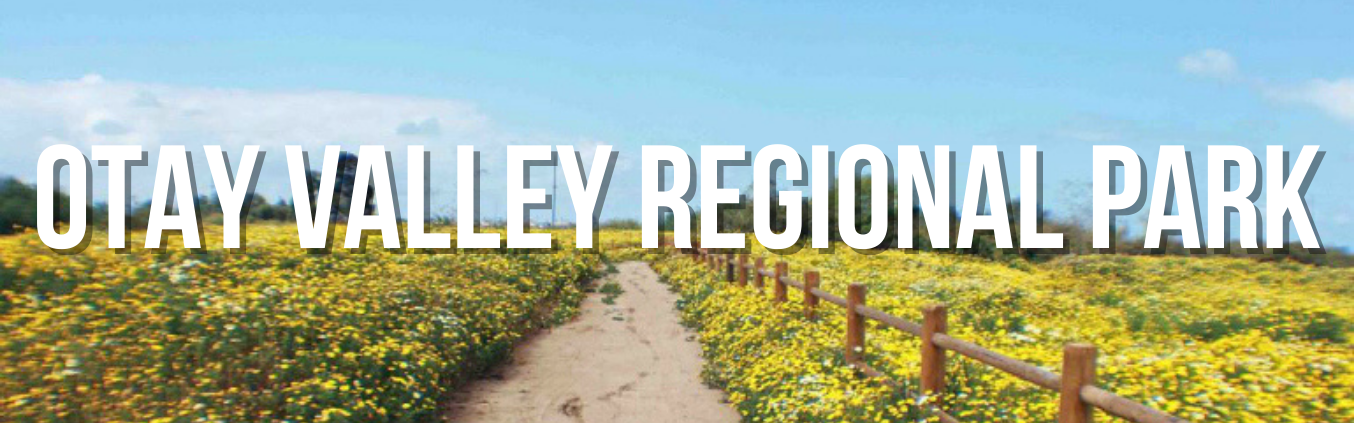
Otay Valley Regional Park
Land Manager: City of San Diego, County of San Diego, US Fish and Wildlife, City of Chula Vista and others
RESOURCES
- Otay Valley Regional Park webpage - County of San Diego
- Otay Valley Regional Park Concept Plan.
- TrailForks - Otay Valley Regional Park
Otay Valley Regional Park (OVRP) is a multi-jurisdictional planning effort by the County of San Diego and the cities of San Diego and Chula Vista and others. In 1990, the jurisdictions entered into a Joint Exercise of Powers Agreement for coordinated planning, acquisition, and design for OVRP.
The planning area for Otay Valley Regional Park is located four miles north of the International Border. The regional park will extend about 11 miles inland from the southeastern edge of the salt ponds at the mouth of the river, through the Otay River Valley, to the land surrounding both Lower and Upper Otay Lakes Reservoir. The Otay Valley Regional Park represents one of the major open space areas within southern San Diego County, linking South Bay with lower Otay Lake Reservoir. From playing fields and picnic areas to hiking, biking, and horse trails, the park will provide local residents and visitors with a variety of recreational opportunities. At the same time, efforts are in play to protect open space, wildlife, historic, agricultural, and archaeological resources.
Currently, the park offers passive recreational areas including 8.3 miles of non-motorized, multi-use trails, extending from the San Diego National Wildlife Refuge to I-805 and a Ranger Station located at 2155 Beyer Boulevard. Also featured are seven staging areas, seven ponds and birdwatching opportunities. OVRP is also home to the Greg Cox Bike Park opened in 2021.
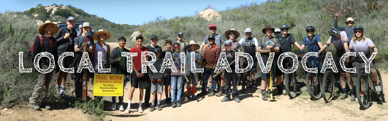
SDMBA executive Director, Susie Murphy, has been on the OVRP Citizen’s Advisory Committee since 2018 and is currently Vice Chairperson of the group and is part of the Trails Committee. Holding seats on committees like this is very important so that mountain bikers have a seat at the table and so that trails are kept high in the agenda.
Since 2018, SDMBA has helped plan and support of Off Road Option as part of the annual Bike the Bay Event. Each August, this optional route allows riders to experience the OVRP loop, many of whom have not ridden there before.
Currently, the formalized trails end at the I-805 there are ongoing plans to extend the trails eastward to eventually connect all the way to Otay Lakes County Park and Lower Otay Reservoir. Some of these planned alignments are part of the Otay Regional Trail Alignment Study.
2023: SDMBA obtained some funding from the City of San Diego and County of San Diego to implement some trail improvements, including a board walk, on a section of trail that floods seasonally just east of Beyer Way. The improvements will keep trail users on a clear alignment and discourage alternate, braided paths taken to avoid an extensive muddy area which degrades the surrounding habitat.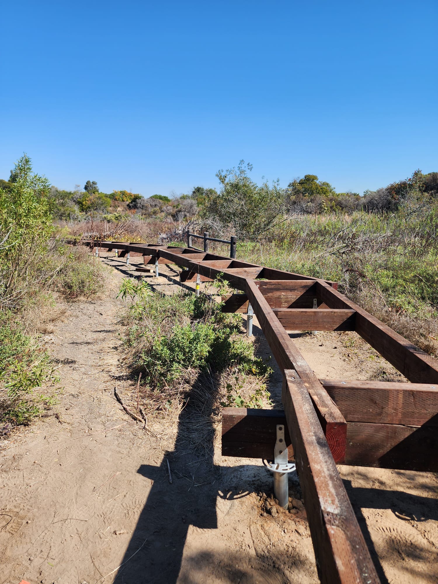
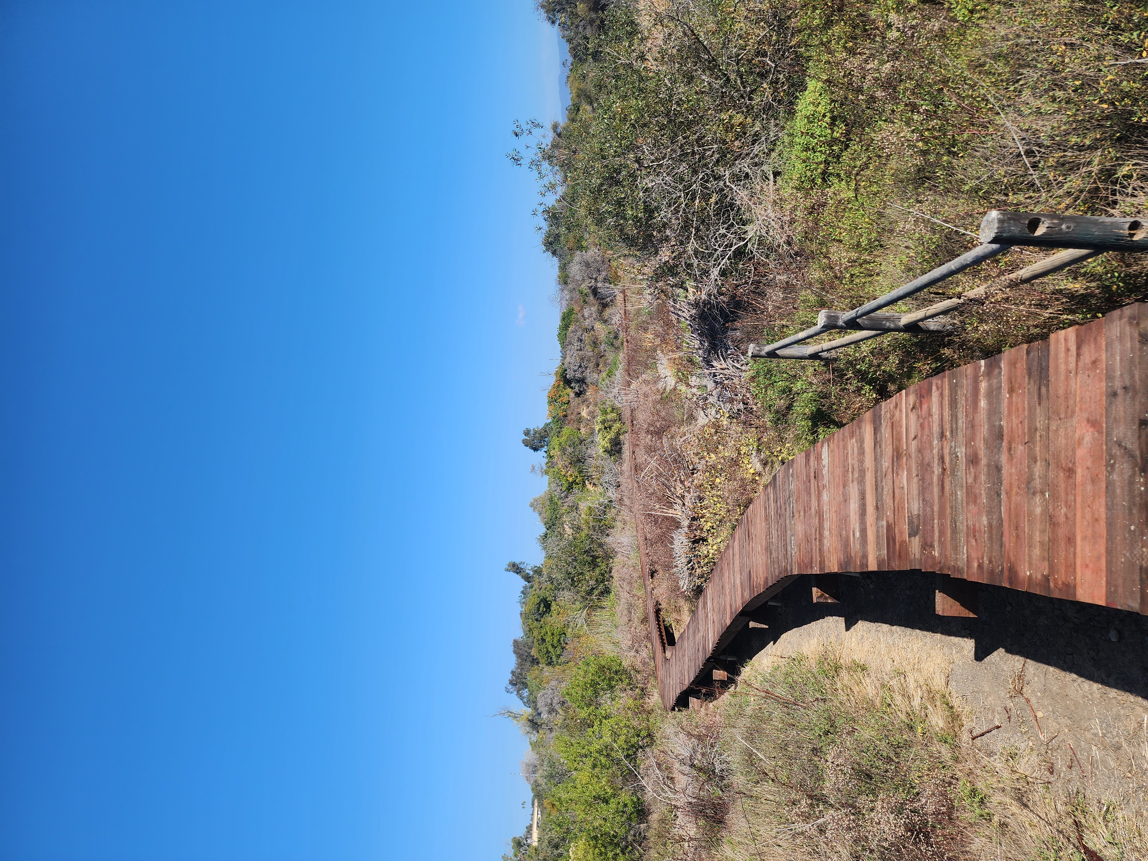
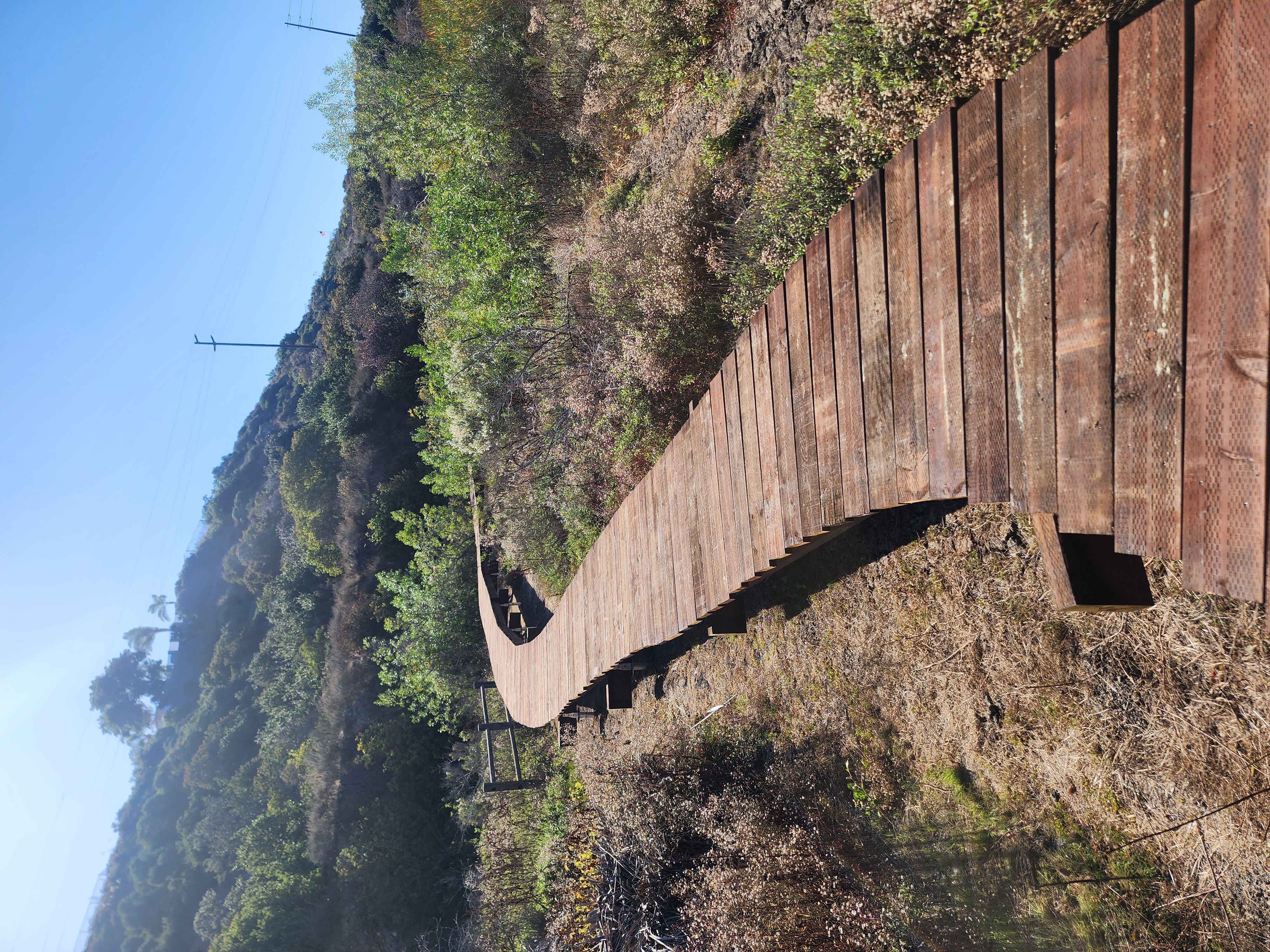
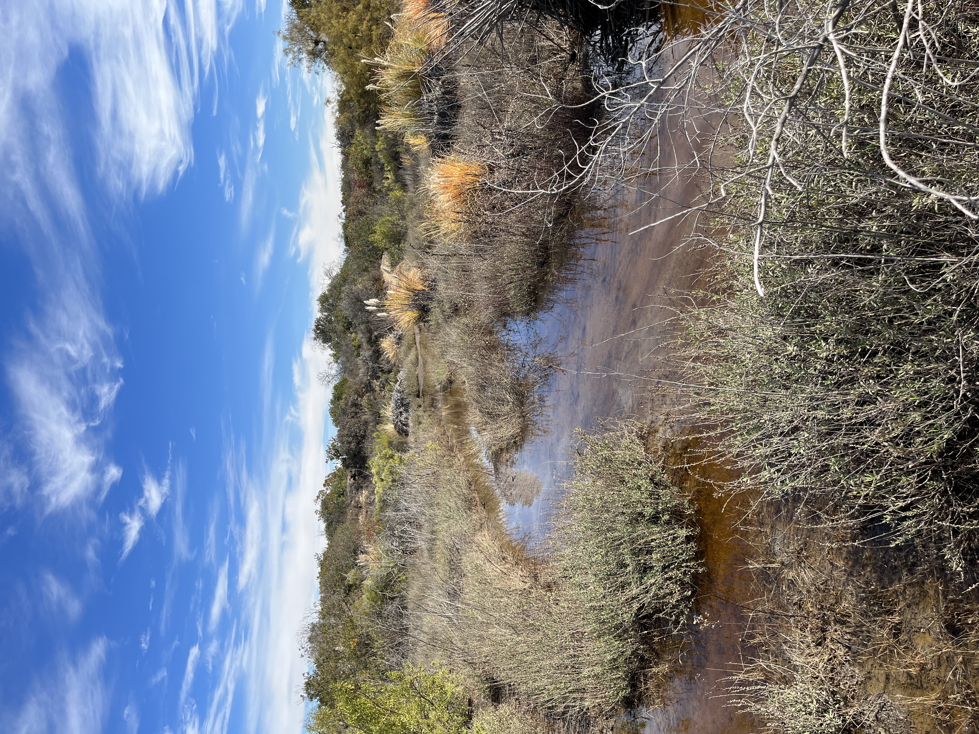
Board Walk under construction. Boardwalk completed November 2023 Flooding - November 2022